
Uramashu Outer Rim Mountains Kaminokoike Pond Trail
The mysterious path that leads from Lake Mashu to Kaminoko Pond
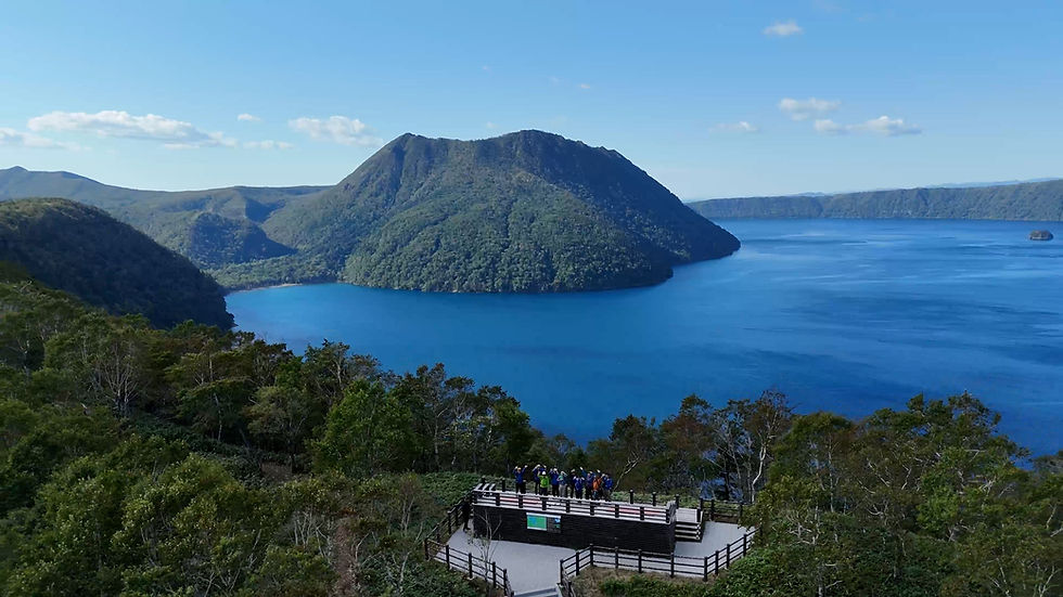
The Uramashu Outer Rim Mountains Kaminokoike Pond Trail is a special route located in the Kiyosato area of the Hokkaido East Trail. The magnificent view of the caldera lake, Lake Mashu, seen from the Uramashu Observatory, surrounded by crystal clear air, and the mysterious, emerald-green Kaminokoike Pond capture the hearts of visitors. The scenery is truly moving and worthy of being called a "primal landscape."
Uramashu Outer Rim and Kaminokoike Pond Trail official website
Eastern Hokkaido is home to wild animals and human activity in a harsh natural environment. On the Hokkaido East Trail, you can enjoy hiking while experiencing nature and the lives of local people. However, it is essential to prepare for and deal with risks such as encounters with wild animals and sudden changes in weather, as well as be considerate of local people. Also, when hiking long trails, safety is fundamentally your own responsibility. Be sure to gather sufficient information in advance and make a solid plan before hiking. For more information, please see the official Hokkaido East Trail website below.
Hokkaido East Trail Official Website Walking the Trail
Route Data
17.0km
Distance
Approx. 8 hours
Duration
Intermediate
Fitness level
<About physical fitness level>
Beginner: Can hike for more than 3 hours.
Intermediate: Can hike for more than 5 hours.
Advanced: Hiking with overnight stays possible
Highlights


Route Map
Recommended Route
Access to the Trailhead
Lake Mashu First Observation Deck
5.6km
Mt. Mashu Hiking Trail Junction
5.3km
Uramashu Observation Deck
6.1km
Kaminokoike Pond
Access from the Trailhead
Each hiking trail is part of the Hokkaido East Trail. Walking is not recommended in winter, so please check the official website for the latest information on road closures and other information.